My college friend John C. is still on his mission to visit all inhabited islands in the British Isles (I have previously written about our visit to several Scottish Isles in September 2020). Having visited nearly 200 islands he is nearing the end of his quest. In April I joined him on his trip to the Channel Islands where we paid a visit to all islands bar one, Brecqhou, a private island where permission to visit was not granted.
 |
| Aurigny Air |
I flew into Guernsey on the reasonably priced Aurigny Airlines flight from Manchester - so much cheaper and quicker than driving to the South Coast and catching a ferry. Since I arrived before John I set off from the hotel (the quite lovely Fleur du Jardin in Kings Mills) for an exploratory walk.
 |
| Ruette Tranquille |
The roads are quite narrow, in fact so narrow that is acceptable for cars to drive on the pavement whenever they need room to pass each other. They also have a lot of Ruette Tranquilles which are particularly narrow roads where they have a 15 mph speed limit.
While Guernsey and the other Channel Islands are fiercely British, being British Dependancies, the majority of street names are in fact French. The islands haven't been French since the 1300's and I wouldn't have expected that all the roads date from that time but somehow French names have survived and perhaps grown.
 |
| The Little Chapel |
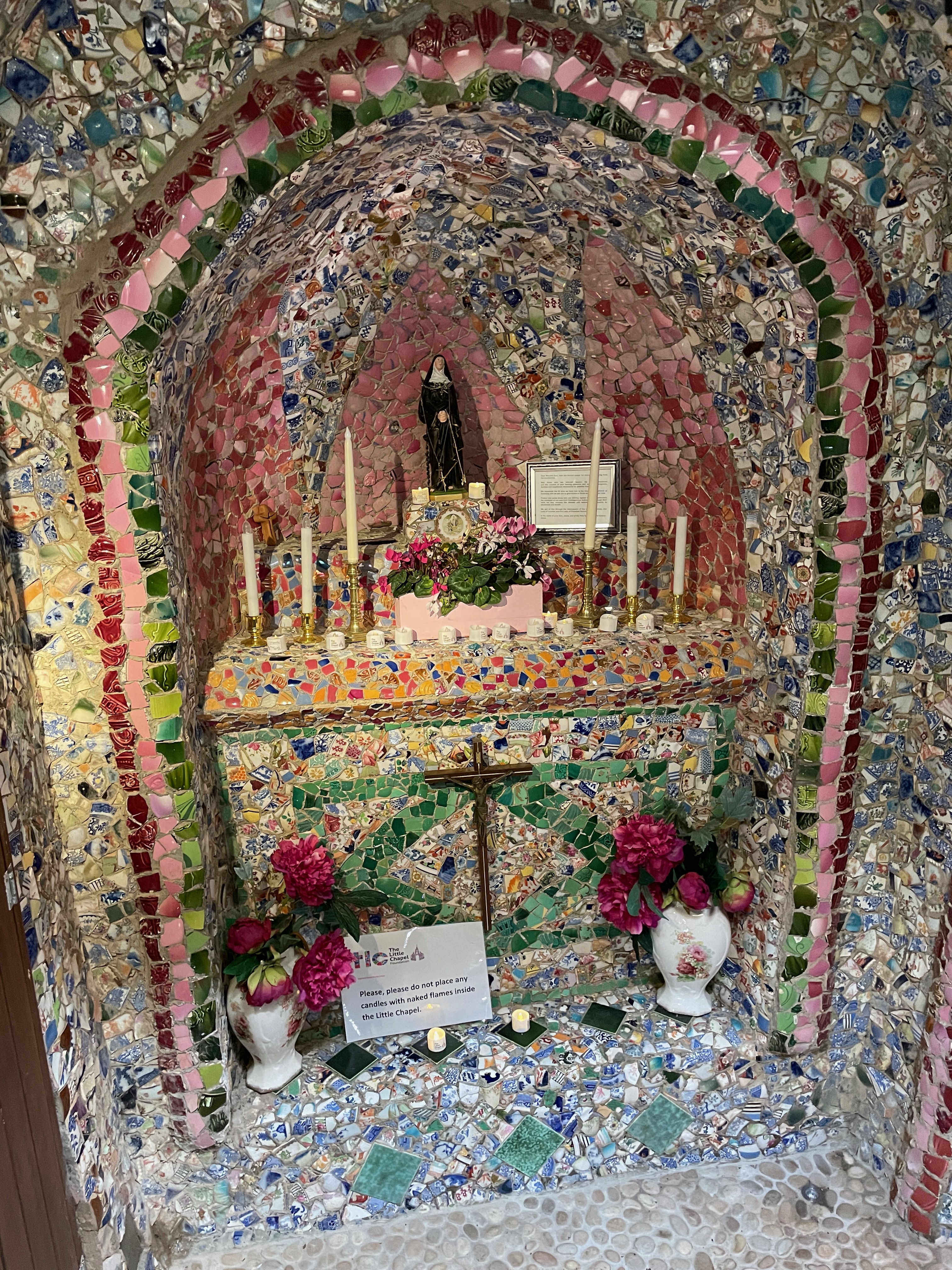 |
| The Little Chapel Interior |
I walked southwards to the nearby Little Chapel - a very small church barely big enough for one or two people that was built in 1914. It was intended to be a miniature version of the basilica at Lourdes and it looks quite amazing being entirely covered with pieces of old crockery.
 |
| Vazon Bay |
 |
| Fort Hommet |
From the Little Chapel I walked over to the north coast at Vazon Bay. This is a beautiful bay with a 19th Century Martello Tower (of many around the coat of the British Isles) and then on the east side of the bay Fort Hommet which is a Victorian era defense that had been reinforced and improved by the Germans during their occupation of the island in WWII.
 |
| Martello Tower |
John arrived later in the evening and we had a few drinks and a nice meal in the hotel before calling it a day.
 |
| The Harbour, St Peter Port |
The next morning we were off to Herm on the ferry from the capital of Guernsey, St Peter Port. It was a nice day but quite cool when we got out to sea. We landed in Herm on the Rosaire steps and made a call over to the private island of Jethou across the bay. Jethou is leased from the crown by one Sir Peter Ogden (of ComputaCenter fame) and John had contacted Sir Peter to see if we could visit. He agreed and he sent a boat over to pick us up after our ferry docked.
 |
| Our Ride to Jethou, and the Herm Ferry |
The boat was a Sea Legs inflatable. It has wheels at the front and back and when we reached Jethou the wheels came down and we drove up the slipway into the garage. Pretty slick.
 |
| Safely Parked in the Garage |
Sir Peter was not in residence (he has places elsewhere on the globe) but the island manager gave us a map and set us off on the trail around the island. It was a most pleasant walk of only a couple of miles. They are trying to grow vines on south side of the island and on the west side there is a small hut. This was the writing hut of Compton Mackenzie (Whisky Galore, Monarch of the Glen) who leased the island in the early 1920's. The hut was well preserved and surprisingly unlocked.
 |
| ComptonMacKenzie's Writing Hut |
Back around the north side of the island we passed the main residence, gardens and swimming pool. We completed the circumnavigation and one of the employees (it takes 4 full time employees to maintain the island) took us back to Herm.
Back on Herm we had lunch in the local pub complemented by a couple of pints of Thatchers Haze cider.
 |
| Belvoir Beach |
John stayed at the pub while I set off to walk around Herm (John is not as mobile as he once was when he walked around the coast of Britain so he was ore inclined to rest than walk). I crossed over to the east side of the island past St Tugual's Chapel and over to the beautiful Belvoir Bay. Further to the north there is the wide and expansive Shell Beach (oddly without many shells). Walking back towards the west side of the island and the harbour there were many nesting burrows of puffins. Alas there were no puffins there - it wasn't their season.
 |
| Shell Beach |
Back in the harbor there was just time for another cider before we boarded the ferry (The Isle of Herm) for the return trip to St Peter Port.
 |
| Leaving Herm |
The next morning we were off on our boat to Alderney. This was the most distant island and most people fly from Guernsey to Alderney. We however had bookings on the fast boat, the Salty Blonde, which was quite fortuitous as the aircraft had a mechanical problem and was not operating that day. The Salty Blonde was only an 8 passenger boat so it was hard to see how it made money though I did learn that the service receives financial support from the local government.
 |
| The Salty Blonde, our ride to Alderney |
The visibility was quite limited and there was a low mist on the sea so we could not see much - thank goodness for the boat's radar. We had booked a taxi tour of the island and as we walked up the jetty we saw our ride was waiting. Dave of Dave's Taxis was there to take us around and regale us with stories of the island and its dark past during the occupation. Dave was convinced that far more deaths in the German prison camps took place than the records tell. He felt there were an order of magnitude more deaths. Whatever the truth there were some dark things that went on during the German occupation.
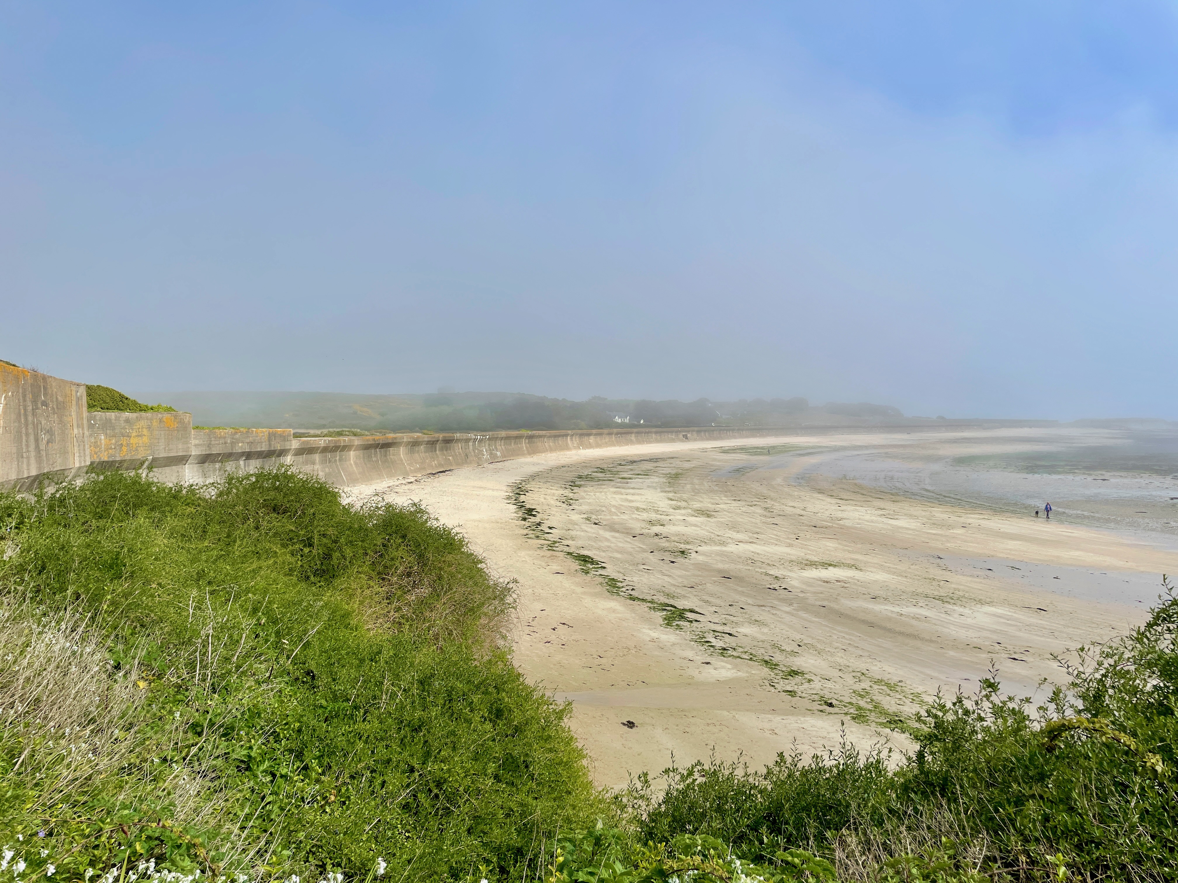 |
| Fortified Beach, Alderney |
 |
| Coastal Defenses |
Dave took us around the perimeter of the island pointing out various memorials, defensive forts and gun emplacements. We stopped and looked around an old Roman Fort now known as the Nunnery. There wasn't much to see of the Roman ruins but the site had periodically been improved in the 17th and 18th centuries and was once a nunnery from where it's current name was taken. In WWII the Germans added to the site with beach defenses and gun emplacements.
 |
| One of Andy's Alderney Balls |
On the wall of the site was one of Andy Goldsworthy's massive clay balls. He placed 11 of these balls at various locations around the island in 2011. The idea is that they will slowly erode and disintegrate. This one over 10 years later is weathered but still quite large.
 |
| Blue not Red Post Boxes |
The main town of St Anne's is very nice, if a bit touristy. We had a coffee and croissant and then I headed out for a walkabout. I really liked the blue post boxes in the Channel Islands and the ones on Alderney were even more interesting being decorated with knitted tops.
 |
| George M lived here |
Several notable people have lived on Alderney - the cricket commentator John Arlott, the cricketer Ian Botham, the Beatles producer George Martin, Julie Andrews. I thought George Martin's house was quite modest for such a famous man - the fifth Beatle.
 |
| George Martin's modest house |
We returned to the harbour after lunch and boarded our boat back to Guernsey. It was a shame that the weather didn't really clear all day. We did not really have any good visibility.
 |
| Cream Tea |
In St Peter Port we indulged in a cream tea before I set off to explore Castle Cornet, the fortification on the tip of the pier protecting the St Peter Port's harbour.
 |
| Castle Cornet |
After Castle Cornet I searched out Victor Hugo's house. Apparently he was exiled here in 1855 and stayed for 15 years until Napoleon III's empire fell and he was allowed to return to Paris. He wrote Les Miserables in Guernsey. It was closing time at the museum so I didn't get inside.
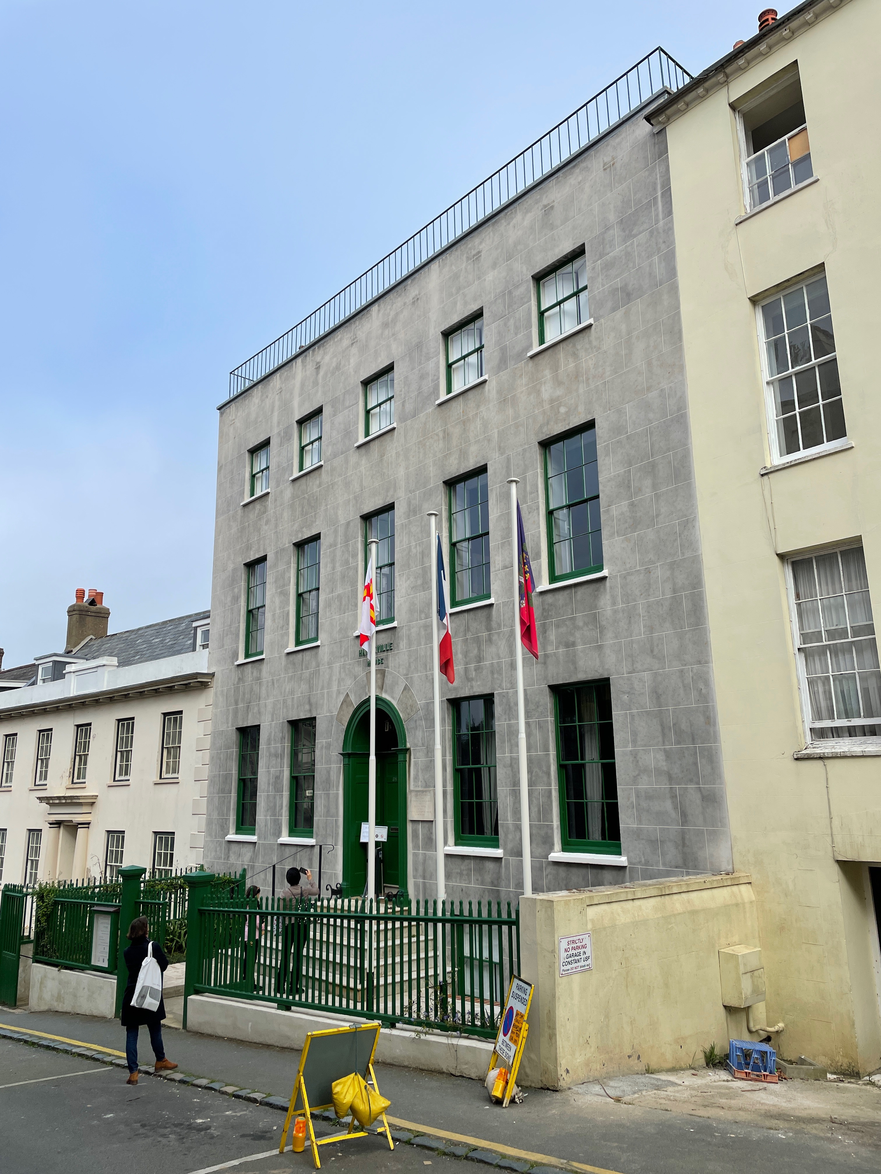 |
| Victor Hugo's House, Guernsey |
The next day's island was Sark. We caught the ferry in the morning with a boat load of other tourists and were dropped at the harbor on the east coast of the island. There are no cars on Sark, just bicycles, horse drawn carriages and tractors pulling the tourists up the hill from the harbor.
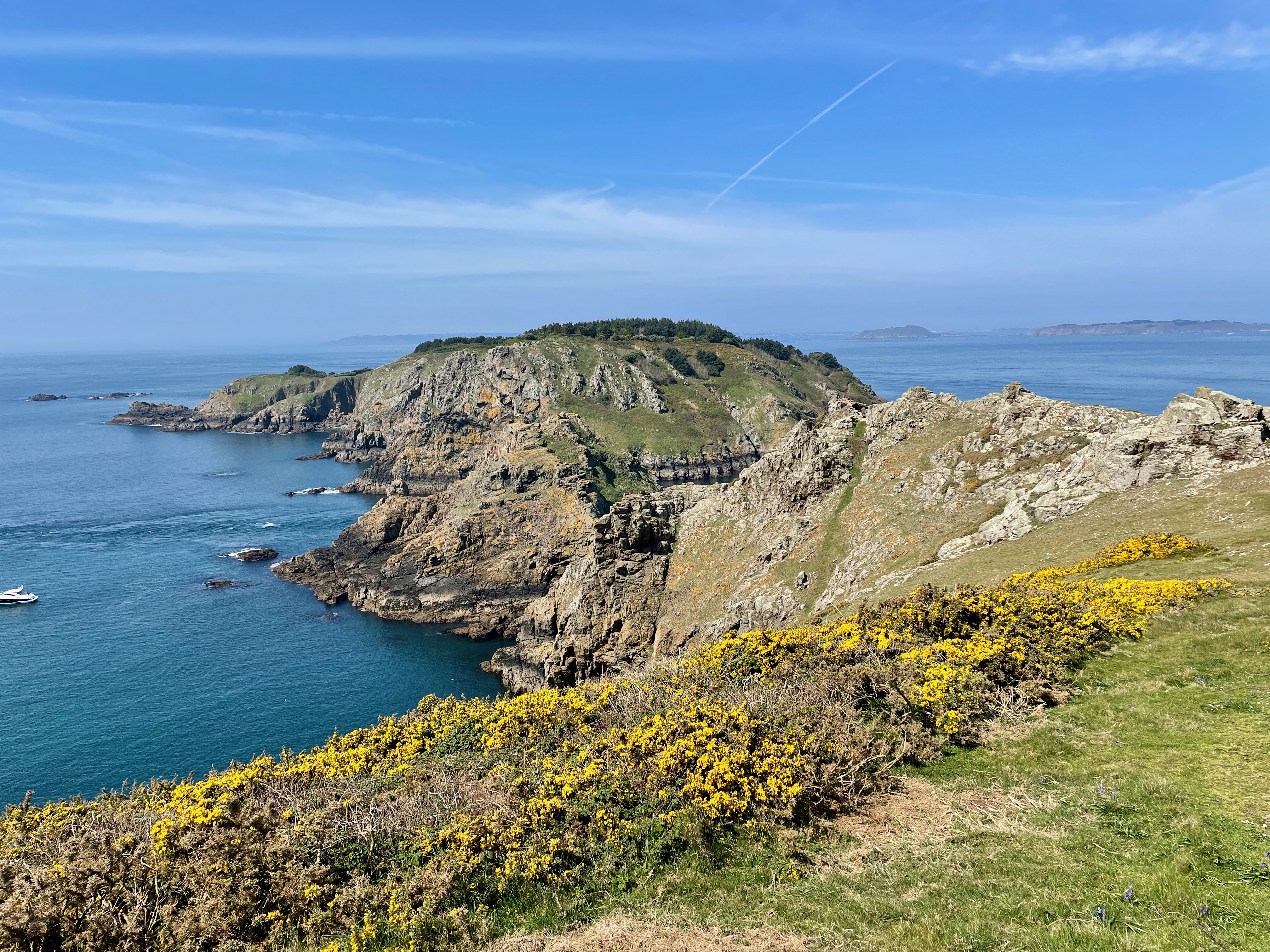 |
| Brecqhou from Sark |
The sister island to Sark is Brecqhou. A small private island off the west coast of the island. This island is owned or rather leased by the Barclay Brothers. One of these financier twins has died but the other still owns the lease. They appear not to be well liked in the islands as they seem to be quite the unacceptable face of tax evading capitalism. They did not respond to John's request to visit the island so this is one of the islands he will not be able to set foot on.
To compensate we did walk over to the west side of Sark to get a good view of Brecqhou. We enquired about hiring a small skiff to make a stealth beach landing but even that did not seem possible.
The west side of the island with the view of Brecqhou is a Ramsar Site. I didn't know what a Ramsar Site was but John clued me in. It is a wetland site of international importance. There was a convention in 1971 in Ramsar in Iran where it was determined that such important wetlands should be identified and preserved. There are many of them around the world, including on Herm and Jethou where we were earlier and where we didn't even know they were Ramsar sites.
It was a very pleasant walk around the island. Lots of flowers were blooming and, as opposed to the prior day, the sky was clear and there was great visibility. We adjourned to a pub for a beverage and then I set off to walk to the north side of the island.
 |
| La Seigneurie |
On the road out to the north there is a nice church and La Seigneurie. The Seigneurie is the house of the head of Sark - the Seigneur. It is quite an impressive house with beautiful gardens.
 |
| La Seigneurie Gardens |
Back at the pub there was just time for another cider before we left for the ferry back to Guernsey. Sadly my impression of Sark was tainted by there being quite a lot of tourists there. The ferry deposits a large number every day and they make the central area of the island quite busy. Once you get out to the fringes of the island it is quieter but the center felt a little cheesy and touristy.
However, Mervyn Peake lived on Sark - who knew.

Back in Guernsey we took a taxi to the airport where I rented a car. This was going to be our transportation for the last day on the islands. We drove around the island as best we could (it is not a straightforward thing to navigate the roads and country lanes of Guernsey).
 |
| German Coastal Defenses everywhere |
We did manage to find the location of our next island, Lihou. This is over on the north west side of Guernsey and is connected by a causeway accessible at low tide. When we saw it in the afternoon the tide was in and the expanse of water to the island looked formidable and it was difficult to imagine being able to walk over to the island - there was quite an expanse of sea to cross.
 |
| High Tide at the Lihou Causeway |
The next day we set off to further explore Guernsey in our car. There was a World War II Occupation Museum that we wanted to see and we had to get out to Lihou when the tide was out. The museum was interesting with lots of artifacts from the war. It truly was a terrible time for those residents of the island that remained during the German Occupation - food was scarce and most of it went to the occupiers.
 |
| The Lihou Causeway at Low Tide |
The tide was out around midday so we made our way to the Lihou Causeway. What a difference a few hours made. There was now a wide expanse of rock and seaweed with a primitive causeway through the middle. We walked over to the island and I did a quick walk around the perimeter.
 |
| Lihou Priory |
There was the ruin of a 12th century priory and a nice pool of water they called the Venus Pool, a large house that you can now stay in, but it is a very small island.
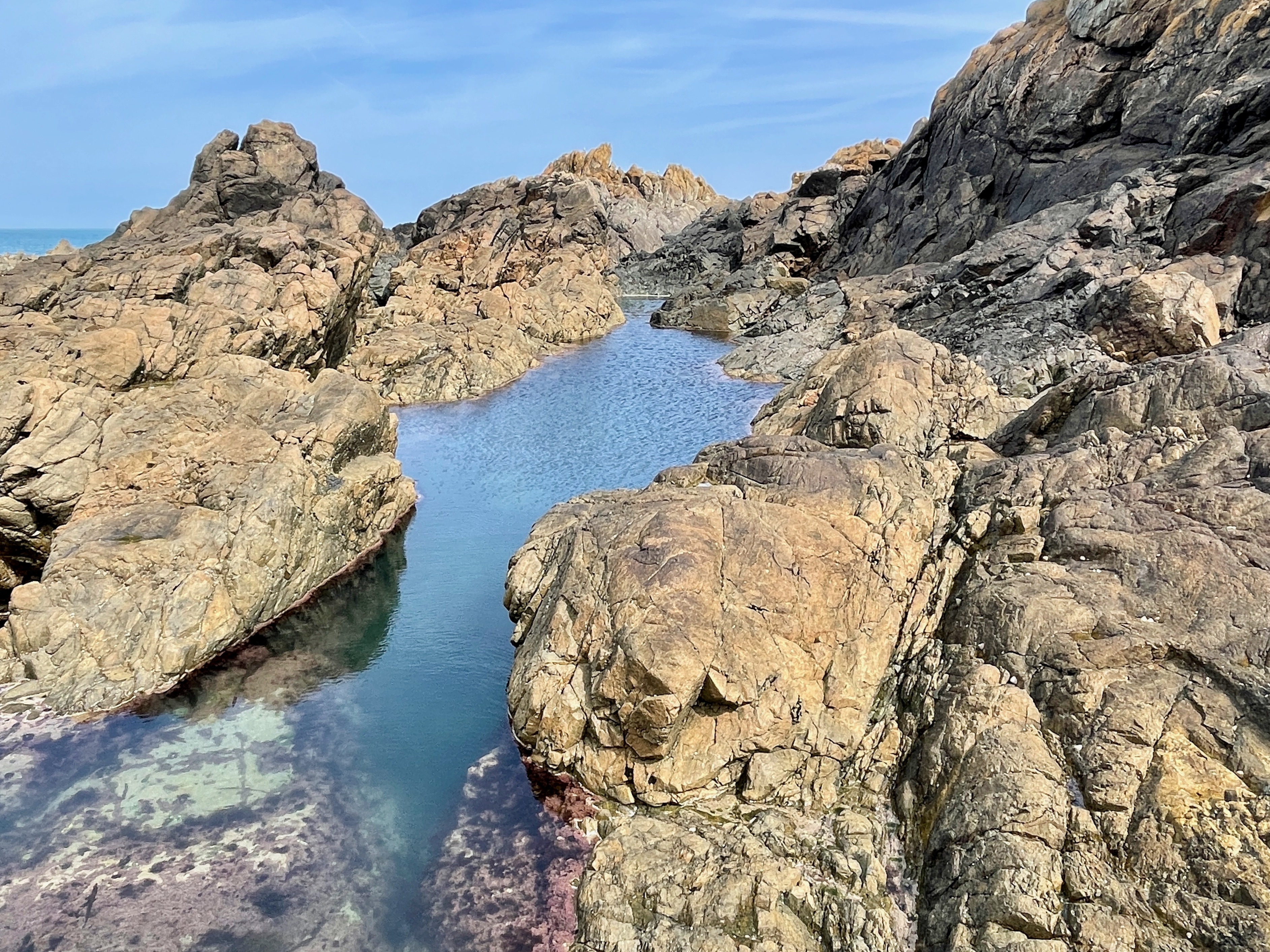 |
| The Venus Pool, Lihou |
We took in the view for a while and then walked back across the causeway before the tide came in again.
This was the end of my stay. John was staying longer and was going over to the island of Jersey later on. I dropped him back at the hotel and then went to the airport for my flight back to Manchester. A most satisfying trip to a beautiful part of the world.