In these times of self isolation and inability to travel I turned back to hiking and trail running. One of the things I have been wanting to do for a long time was to complete the circumnavigation of Lake Tahoe on the Tahoe Rim Trail. The TRT is a 165 mile trail primarily along the crest of the mountains surrounding what is truly one of the most beautiful lakes anywhere. I had hiked bits of the trail before but these days I don't like to carry a back pack for too far or for too long, so running the trail seems like a better option. I did trail runs on the eastern side of the lake a couple of years ago and the only bit I had left to do was the western side through the Desolation Wilderness and Granite Chief areas and a bit of the northern edge near Mount Rose. At the end of June I decided to get serious about it so what follows are descriptions of several runs to complete this endeavor.
Tuesday, 30 June - Echo Summit to Dick's Pass
Since the best part of the day is the early morning before things get too hot, I set off at the ridiculous hour of 4:15am to drive up to Tahoe. I arrived at Echo Summit just before 6:00 am and parked in the Echo Lake parking lot. I was on the trail just after 6:00 and received some strange looks from the early morning anglers fishing off the bridge that spans the outlet from the lake. I am sure we both thought the other was crazy for being there at such a ridiculous hour with such a ridiculous pastime.
 |
Echo Lake
|
The first part of the trail runs above the east side of Echo Lake. Echo Lake has cabins along its shores, quite nice cabins too and not all that primitive, some were quite well appointed. I was feeling quite pleased with myself at having got so early and I really enjoyed the run alongside the lake. The trail was a bit rocky and it does gain in altitude but it was not too difficult to run on. The views were spectacular with the lake and Mt Ralston and Pyramid Peak in the background.
In normal times there is a boat service that takes you between the southern end of Lower Echo Lake through the narrows to the northern end of Upper Echo Lake. That would have save me a couple of miles on the way back but in these coronavirus days the boat service is not running.
 |
Lake Aloha
|
After passing Lower Echo Lake and the smaller Upper Echo Lake the trail skirts the side of the hill past Tamarack Lake and through Haypress Meadows before dropping down past Lake Lucille and Lake Margery to the Aloha Lake basin. Lake Aloha is a spectacular lake - quite large and almost above the tree line so it presents nice wide open views along its shoreline. It is a very popular camping spot for day trippers from Echo Summit and for PCT through hikers.
 |
Lake Aloha
|
This section of the Tahoe Rim Trail is the same path as the Pacific Crest Trail so it is a major trail and difficult to get lost on (that being said I did get off trail twice on the way back when I wasn't paying attention). After leaving the Lake Aloha basin the trail drops slightly to skirt Heather Lake and Susie Lake before once more starting to rise again. By this time I had done over 10 miles and while I wasn't feeling too bad I knew things would be getting worse for the way back. Still I was within a few miles of Dick's Pass so I decided to push on and make it a longer day. Dick's Pass would make a good point to approach the trail from the other direction when I came to do that section.
 |
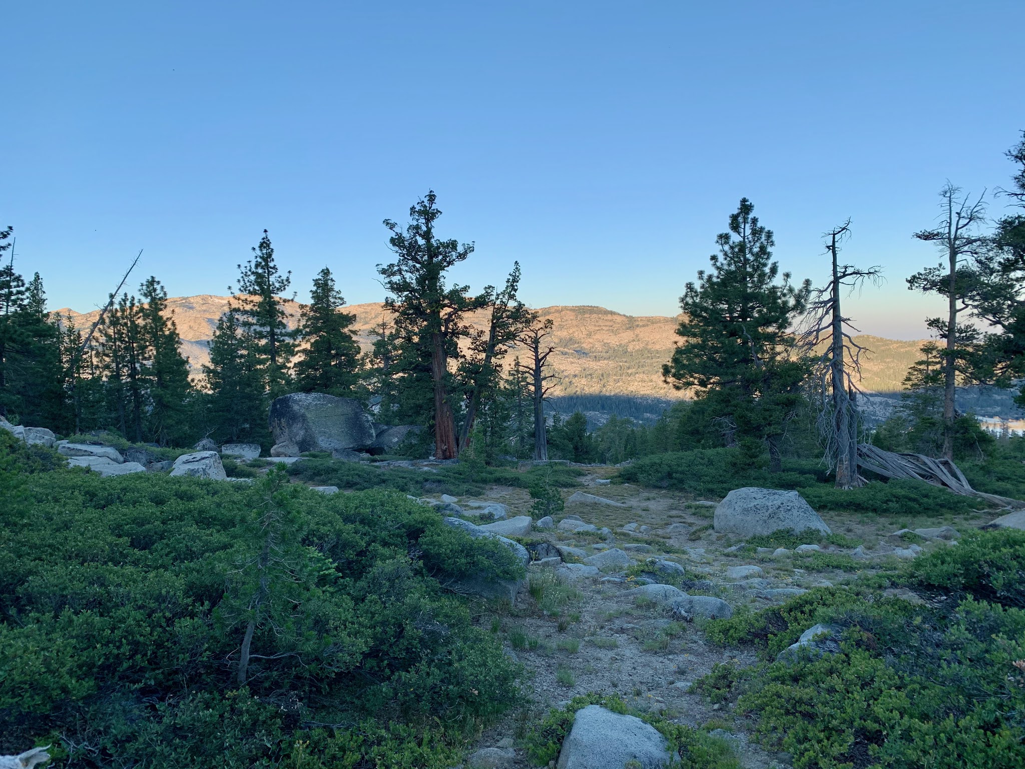
From near Dick's Pass looking south
|
The climb up to Dick's Pass was quite arduous and seemingly never ending. The reward at the pass was magnificent views down to Dick's Lake and the mountains to the north and even more magnificent views back down the trail towards Half Moon Lake and Lake Aloha. My starting point at Echo Lake was at an elevation of 7400 ft and Dicks Pass is at 9400 ft so that was 2000 ft of climbing. The air was certainly a little thinner up there and it was blowing a little cooler.
 |
Dick's Pass - 9400 ft
|
At the time I didn't know who Dick was but he certainly did quite well in that area with a mountain - Dick's Peak, a pass - Dick's Pass and a lake - Dick's Lake named after him. I later found out that he was Captain Richard Barter, an Englishman, a sea captain, whose nickname was the Hermit of Emerald Bay. He was hired as caretaker of a villa built on Emerald Bay and he had quite the hard life living alone during the long winter months in the villa. Boat access was the only way in and out of the villa in winter and on one of his trips to South Shore he capsized and drowned. His
story is told here.
I didn't hang around at the pass for too long as it was getting late. I was at 13.5 to 14 miles at that point and I knew it was going to be a tiring run back. The real problem was that not much of the trail was easily runnable. It was a rubbly and rocky trail that didn't lend itself to running even on the downhills. As a result progress was slow.
I did get off on the wrong trail a couple of times. That was hard to do but I guess I just wasn't paying attention. I did correct it of course but an extra mile or two was not what I wanted. There were some dark periods in the middle of the way back when I just wanted to sit down and rest for a while but I really couldn't afford to. My mood lifted once I got back to the Aloha basin and things started moving a little easier.
 |
Lake Aloha on the return
|
That being said, the last few miles were certainly more of a walk than a run but I managed to make it back around 6:00 pm and my phone said I had done 29 miles. A good day but it did take me 12 hours to do it so that is not all that fast. It was enough for one day though and I was very relieved to see the car again and have some proper food.
That night I spent in North Shore where Nancy had a condo rented for a couple of days.
Thursday 2 July - Barker Pass to Rubicon Trail
Feeling more or less recovered I decided to do a short section of the trail before I left Tahoe on the following Thursday morning. This was an out and back section, 4 miles out, 4 miles back from Barker Pass south to the point where the Rubicon Jeep Trail crosses the trail.
 |
Barker Pass Trail Head
|
From lake level the Barker Pass Road goes up to the summit and is a nicely paved road much favored by cyclists in need of some hill work. Since the road stops just after the summit there is little traffic on the road except for hikers gaining access to the PCT and TRT and so it is perfect for cyclists.
 |
South from Barker Pass
|
The hiking trail south from the trailhead is nice and easy going. Gently down and gently up but nothing too severe. After the previous rocky trail by Echo Lake and up to Dick's Pass it was a joy to be able to run on smooth dirt trails. The scenery here is not spectacular as nearly all the way it was in the trees so there was no view out over the surrounding countryside. However being in the trees it was nice and cool.
I polished off the 8 miles in a couple of hours and was back in the car before lunchtime and down the hill to Sacramento by mid afternoon.
Sunday, 5 July - Dick's Pass to Phipp's Peak via Bayview Trail
0n the next Sunday morning it was another early start for the Tahoe area. This time to pick up where I left off at Dick's Pass earlier in the week. Of course that was not such an easy thing to do as I had to get into the Dick's Lake basin by going up the Bayview Trail from Emerald Bay on the side of Lake Tahoe. That is a climb all by itself and at least 4 or 5 miles.
 |
Emerald Bay, Lake Tahoe from Bayview Trail
|
So I was out of the house around 4:00 am and I arrived at the Bayview Trailhead on Emerald Bay around 6:00. The trail affords wonderful views of Lake Tahoe but it is quite brutal in its ascent. It is the best part of 2 miles of switchbacks up the side of the hill. On top it was a mostly gentle downhill runnable section to Dick's Lake and the start of the trail up to Dick's Pass. The trail up to Dicks Pass from the north side is a lot better than coming up from the south. It is a series of gentle, mostly runnable, switchbacks up to the top. The pass is at 9400 ft and my starting point on Lake Tahoe was around 6300 ft. So that is 3100ft of gain - quite a climb.
 |
Dick's Lake
|
The descent down from Dick's Pass was just wonderful - gentle downhill with a nice smooth footing. The trail drops down to Dick's Lake and then skirts around the edge of Fontanillis Lake which in my opinion is on of the more beautiful lakes in the area. The trail then drops down to Middle Velma Lake. This area again is a popular camping spot for weekend backpackers as well as for through hikers.
As I was feeling fairly good I decided to go a little further so as to make my next section a little shorter. I headed past Middle Velma Lake and on towards Phipps Peak. It was a gentle climb up towards Phipps Peak and when I reached the junction with the trail up to the peak (and on to Meeks Bay) I turned around.
 |
Near Velma Lakes
|
The way back was a little shorter as there was a cutoff over to the Bayview Trail. It was a relief to finally reach the top of the Bayview trail knowing that it was all downhill from there, albeit a steep and long downhill. At the end of the day my phone told me I had done 18.5 miles.
Thursday 9 July - Barker Pass to Tahoe City
Having recovered from Sunday's run, I decided to have another go at the trail. This time I tackled the section from Barker Pass to Tahoe City. This section is 16.7 miles so an out and back would just not be doable by me. Fortunately my friend, George Troy was up in Tahoe and I persuaded him to pick me up when I had finished and take me back to my car.
 |
Sunrise over Lake Tahoe
|
For some reason I was awake early on Thursday morning (at 2:30) so I decided to get an early start. I was at the trailhead at the summit of Barker Pass Road by 5:00 am and it was still dark. By the time I had got sorted out and ready to run there was just enough light to guide my way so off I went. This section is predominantly downhill. Barker Pass is at 7650 ft and the end in Tahoe City is 6300 ft.
 |
View to the South West from TRT
|
 |
| Beautiful trails for running |
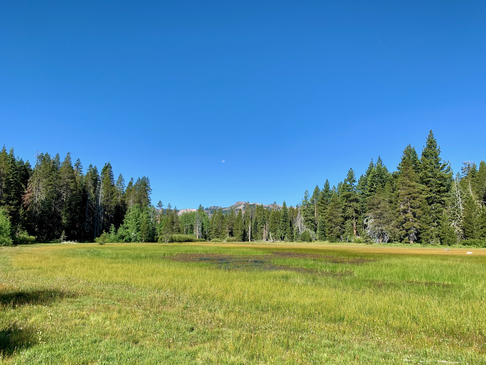
It was an enjoyable run too. Nice views over into the Granite Chief area before the Tahoe Rim Trail splits off from the Pacific Crest Trail and drops down into the Tahoe Basin. After some lovely downhill trail sections the trail joins Ward Creek Road and follows it for a while before climbing up to Page Meadows and then finally dropping down to Tahoe City.
 |
Page Meadow
|
After all the rocky trails encountered around Dick's Pass and Lake Aloha, this trail was just beautiful - smooth for the most part, shaded, slightly downhill. What more could you ask for.
I arrived in Tahoe City on the banks of the Truckee River where there were literally dozens of rafters floating down the river. Six or eight people in a raft with not much social distancing going on. I made a call to George and he came and picked me up and drove me back up the hill to the car. I was done by 10:00 am, back at the car by 11:00 and back down in Sacramento by 2:00. A great day.